U.S. Wind Turbines (USGS Wind Turbine Database)
U.S. · 77,839 locations
There are 77,839 Wind Turbines (USGS Wind Turbine Database) in the US as of October 2026. They are in 46 states and territories.
77,839 wind turbines from the USGS U.S. Wind Turbine Database, release 9.1 of 28 September 2026. USGS builds it with the American Clean Power Association.
More about this list
The turbines stand in 46 states, Guam and Puerto Rico. Another 124 stand in federal waters offshore. Texas has 19,943, Iowa 6,514 and Oklahoma 5,849. Each row gives the project, its year and size, the maker and model, rated capacity, hub height, rotor diameter and total height. It also gives the map point, the county and USGS's confidence in each. GE Wind made 35,326 of them and Vestas 18,247. Together they are rated at 159.6 GW. 8,709 were partly rebuilt after they went up. 129 stand offshore. 72,788 carry the EIA plant id and 74,490 the FAA obstacle id. USGS publishes no owner or operator.
Need just some of them? Ask in your own words.
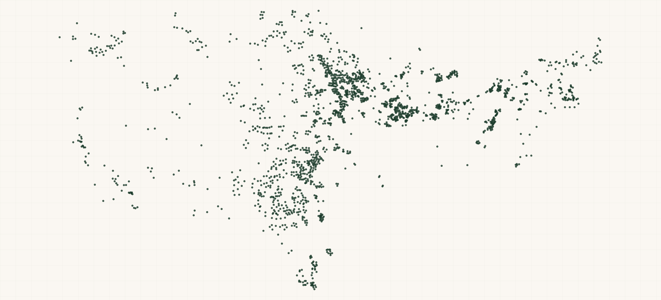
●Where the rows are
≡Sample Data Preview
| name | state | county | county fips | turbine id | project name | project year | project turbines | project capacity mw | manufacturer | model | turbine capacity kw | hub height M | rotor diameter M | rotor swept area M2 | total height M | retrofit | retrofit year | offshore | federal waters | attribute confidence | location confidence | image date | image source | eia plant id | faa obstacle id | faa study number | usgs prior id | section232 sector | row id | source file | source date | directions url | updated date | geo precision | county fips | address quality | country | latitude | longitude |
|---|---|---|---|---|---|---|---|---|---|---|---|---|---|---|---|---|---|---|---|---|---|---|---|---|---|---|---|---|---|---|---|---|---|---|---|---|---|---|---|
| Bethel Wind Turbine | AK | Bethel Census Area | 02050 | 3086174 | Bethel Wind Turbine | 2018 | 1 | .9 | EWT | DW-52-900 | 900 | 50 | 52 | 2123.72 | 75.9 | No | No | No | High | High | 2018-08-18 | Vantor | 6566 | 02-280875 | 2018-WTW-10456-OE | wind turbines | 3086174 | https://energy.usgs.gov/uswtdb/assets/data/uswtdbCSV.zip | 2026-09-28 | https://www.google.com/maps/dir/?api=1&destination=60.780571%2C-161.886581 | 2026-10-27 | source | 02050 | missing | US | 60.780571 | -161.886581 | ||
| 30 MW Iowa DG Portfolio | IA | Story County | 19169 | 3049500 | 30 MW Iowa DG Portfolio | 2017 | 10 | 30 | Nordex | AW125/3000 | 3000 | 87.5 | 125 | 12271.85 | 150 | No | No | No | High | High | 2017-05-13 | Vantor | 19-028030 | 2014-WTE-4080-OE | wind turbines | 3049500 | https://energy.usgs.gov/uswtdb/assets/data/uswtdbCSV.zip | 2026-09-28 | https://www.google.com/maps/dir/?api=1&destination=42.016373%2C-93.515892 | 2026-10-27 | source | 19169 | missing | US | 42.016373 | -93.515892 | |||
| Apple Blossom | MI | Huron County | 26063 | 3077123 | Apple Blossom | 2017 | 29 | 100.05 | Vestas | V126-3.45 | 3450 | 87 | 126 | 12468.98 | 150 | No | No | No | High | High | 2018-12-13 | Vantor | 58690 | 26-109834 | 2015-WTE-3054-OE | wind turbines | 3077123 | https://energy.usgs.gov/uswtdb/assets/data/uswtdbCSV.zip | 2026-09-28 | https://www.google.com/maps/dir/?api=1&destination=43.805984%2C-83.324287 | 2026-10-27 | source | 26063 | missing | US | 43.805984 | -83.324287 | ||
| Anderson Wind Project | NM | Chaves County | 35005 | 3051555 | Anderson Wind Project | 2014 | 8 | 14.95 | Vestas | V100-2.0 | 2000 | 80 | 100 | 7853.98 | 130.1 | No | No | No | High | High | 2016-11-07 | Vantor | 58940 | 35-022580 | 2014-WTW-662-OE | wind turbines | 3051555 | https://energy.usgs.gov/uswtdb/assets/data/uswtdbCSV.zip | 2026-09-28 | https://www.google.com/maps/dir/?api=1&destination=33.014084%2C-103.860741 | 2026-10-27 | source | 35005 | missing | US | 33.014084 | -103.860741 | ||
| Aurora County Wind | SD | Aurora County | 46003 | 3087211 | Aurora County Wind | 2018 | 9 | 20.7 | GE Wind | GE2.3-116 | 2300 | 80 | 116 | 10568.32 | 138.1 | No | No | No | High | High | 2018-07-23 | Vantor | 61745 | 46-039455 | 2018-WTE-6707-OE | wind turbines | 3087211 | https://energy.usgs.gov/uswtdb/assets/data/uswtdbCSV.zip | 2026-09-28 | https://www.google.com/maps/dir/?api=1&destination=43.703773%2C-98.751732 | 2026-10-27 | source | 46003 | missing | US | 43.703773 | -98.751732 |
{}What's in each row
| Field | What it is | Rows filled |
|---|---|---|
| name | Wind power project the turbine belongs to, as USGS names it | 100% |
| state | Two-letter state code (blank for turbines in federal waters offshore) | 100% |
| county | County or county equivalent the turbine stands in (USGS spatial join) | 100% |
| county | State and county FIPS code from USGS's spatial join | 100% |
| country | Country (US) | 100% |
| latitude | Latitude of the turbine (NAD 83), as USGS publishes it | 100% |
| longitude | Longitude of the turbine (NAD 83), as USGS publishes it | 100% |
| turbine | USGS case id: the turbine's unique, stable id | 100% |
| project | Name of the wind power project | 100% |
| project | Year the project began providing power (sometimes estimated from the year the turbine was put up) | 99% |
| project | Number of turbines in the project, as USGS publishes it | 100% |
| project | Capacity of all turbines in the project, in megawatts | 95% |
| manufacturer | Turbine maker (original equipment manufacturer) | 94% |
| model | Maker's model name | 94% |
| turbine | Turbine rated capacity in kilowatts | 94% |
| hub | Hub height in meters | 93% |
| rotor | Rotor diameter in meters | 93% |
| rotor | Rotor swept area in square meters | 93% |
| total | Height from the ground to the tip of a blade pointing straight up, in meters | 93% |
| retrofit | Yes when the turbine was partly rebuilt after it was put up (rotor or nacelle replaced) | 100% |
| retrofit | Year of the retrofit | 11% |
| offshore | Yes for an offshore turbine | 100% |
| federal | Yes for an offshore turbine in federal waters (no state or county) | 100% |
| attribute | USGS's confidence in the turbine's make, model and size: Low, Medium or High | 100% |
| location | USGS's confidence in the turbine's map point: Low, Medium or High | 100% |
| image | Date of the aerial image USGS used to confirm the turbine (NAIP images carry 1 January) | 92% |
| image | Source of that aerial image | 100% |
| eia | EIA plant id: the link to the EIA-860 power plant data | 94% |
| faa | FAA obstacle id (Digital Obstacle File) | 96% |
| faa | FAA aeronautical study number (obstruction evaluation) | 95% |
| usgs | Id in the earlier USGS dataset the turbine came from | 46% |
| section232 | Section 232 investigation the row falls under (wind turbines and their parts) | 100% |
| row | Row id | 100% |
| source | USGS file the row was read from | 100% |
| source | Date of the USGS release (v9.1) | 100% |
| directions | Google Maps directions link to the map point | 100% |
| updated | Date the list was built | 100% |
| geo_ | How the map point was found: source = USGS's own point | 100% |
| county_ | Five-digit county FIPS code | 100% |
| address_ | missing on every row: turbines have no street address, only a map point | 100% |
Rows filled is measured on every row of the delivered file.
✓Where this data comes from
This dataset is compiled from the public directory or register named in its description, one record per location.
October 27, 2026
Snapshot built
40 fields
Columns in the file
Fill measured
On every row of the delivered file
How we build and date every file: methodology.
Using ChatGPT, Claude or an API?
No setup needed. Ask ChatGPT or Claude your question about the U.S. Wind Turbines (USGS Wind Turbine Database) and give it this page: it can open https://locationlists.com/find?dataset=us-wind-turbine-list with the filters you need and show you the count and price.
Using ChatGPT or Claude? Tell it to answer from locationlists.com/find — no account, no connector.
How assistants ask
No connector needed. Any AI assistant can answer from this site with a web link, no connector, no account: open https://locationlists.com/find with the question as query parameters.
If a question needs filtering, distance, combining lists or a price, open a /find link: either put the question itself in q=, or build the structured link. The answer does not need an API, a connector or an account.
Simplest, the question itself: https://locationlists.com/find?q=<the question in plain words>
Or set the parts yourself: https://locationlists.com/find?dataset=<slug>&state=<ST>&city=<city>&county=<county>&zip=<zip>&near=<place or zip>&radius=<miles>&where=<column>:<op>:<value>&total=<rows>
Leave out what the question does not need. Distance is radius, in straight-line miles; near can name several places separated by | to reach from any of them. To ask about several lists at once, use datasets with two or more names, or category with a kind of business. To compare two lists, add relate=nearest and the other list with b. in front of its parameters. To count by area, use areas=county (or zip, state, metro). To keep only places whose county, ZIP code, metro area or state meets a Census figure, add area_where (for example county:population>1000000); with areas, per=100000 gives counts per 100,000 residents.
Links an assistant can open, each showing how many rows match, a few preview rows and the price for just that part:
- Only Texas, the state with the most: https://locationlists.com/find?dataset=us-wind-turbine-list&state=TX
- Within 25 miles of Amarillo, TX, the busiest area: https://locationlists.com/find?dataset=us-wind-turbine-list&near=Amarillo+TX&radius=25
- Only rows where projectYear is over 2017: https://locationlists.com/find?dataset=us-wind-turbine-list&where=projectYear%3Agt%3A2017
- Every Power Plants, Refineries & Fuel Terminals list combined, within 25 miles of Golden Hills, CA: https://locationlists.com/find?category=energy-infrastructure&near=Golden+Hills+CA&radius=25
- Each one's nearest US Power Plants, in Texas, with miles: https://locationlists.com/find?dataset=us-wind-turbine-list&state=TX&relate=nearest&k=1&b.dataset=us-power-plant-list&b.state=TX
- The whole list: add a city, state, ZIP code or distance:
https://locationlists.com/find?dataset=us-wind-turbine-list - In plain words: "U.S. Wind Turbines (USGS Wind Turbine Database) in Texas": https://locationlists.com/find?q=U.S.+Wind+Turbines+(USGS+Wind+Turbine+Database)+in+Texas
- In plain words: "U.S. Wind Turbines (USGS Wind Turbine Database) within 25 miles of Amarillo, TX": https://locationlists.com/find?q=U.S.+Wind+Turbines+(USGS+Wind+Turbine+Database)+within+25+miles+of+Amarillo%2C+TX
Optional: connect for repeat use or wallet payments:
Read https://locationlists.com/skill.md and follow the instructions to connect LocationLists. Then show me the U.S. Wind Turbines (USGS Wind Turbine Database) list.Your assistant will walk you through setup and show you the price before you pay.
For developers
Every step below has a no-connector equivalent: https://locationlists.com/find?dataset=us-wind-turbine-list with the same filters as query parameters.
- Connect your agent to
https://locationlists.com/mcp(no key, no signup). - Call
count_locationswithdataset: "us-wind-turbine-list"and any filter — it is free, and returns how many rows match and what they cost. - Fetch the rows with
query_locations: $0.32 per 100 rows from this dataset. Above 38,920 rows, buying the whole file is cheaper.
Paid in USDC over x402 — the agent gets an HTTP 402 with the exact price, signs, and retries. Money moves only after rows are delivered, so a failed or empty query costs nothing. Setup for Claude, Cursor and VS Code
?Frequently Asked Questions
How many Wind Turbines (USGS Wind Turbine Database) are there in the US?
There are 77,839 Wind Turbines (USGS Wind Turbine Database) in the US as of October 2026. They are in 46 states and territories.
Which turbines are in it?
Every turbine in the U.S. Wind Turbine Database. USGS confirms each one on an aerial image and removes turbines that come down. The list is the release of 28 September 2026.
Does it name the owner or operator?
No. USGS publishes the project name, not who owns or runs it. The EIA plant id on each row links to EIA-860, which names the plant's operator.
Why do some rows have no state?
124 offshore turbines stand in federal waters. USGS gives them no state or county, so those columns are blank. federalWaters is Yes on those rows.
How current is the data?
Snapshot built on October 27, 2026. It is a one-time snapshot and is not rebuilt on a schedule.