U.S. Wind Power Projects (USGS Wind Turbine Database)
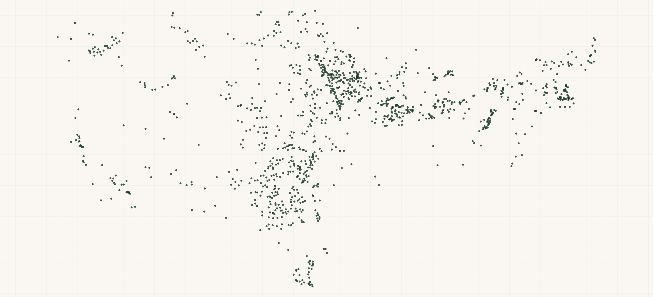
U.S. · 1,825 locations
There are 1,825 Wind Power Projects (USGS Wind Turbine Database) in the US as of October 2026. They are in 46 states and territories.
1,825 wind power projects, built from the 77,839 turbines in the USGS U.S. Wind Turbine Database, release 9.1 of 28 September 2026. A row is one project name in one state.
More about this list
Each gives the turbines the database holds and the project count and capacity USGS publishes. It also gives the year, the makers and models with a count of each, and the ranges of rating, hub height, rotor and total height. 239 projects have 100 or more turbines in the database. 1,428 carry EIA plant ids. The map point is the centre of the project's turbines. USGS could not name 183 groups of turbines and lists them as "unknown <area>". Those rows can cover a whole wind area. USGS publishes no owner or operator.
Need just some of them? Ask in your own words.
●Where the rows are
≡Sample Data Preview
| name | state | county | county fips | project name | project name known | turbines in database | project turbines published | project capacity mw | turbine capacity mw sum | turbines with capacity | project year | manufacturers | models | turbine capacity kw min | turbine capacity kw max | hub height mmin | hub height mmax | rotor diameter mmin | rotor diameter mmax | total height mmin | total height mmax | total height mmean | turbines with hub height | offshore turbines | federal waters turbines | retrofit turbines | retrofit years | counties | eia plant ids | turbines with faa obstacle id | low location confidence turbines | low attribute confidence turbines | image date first | image date last | image sources | turbine ids | section232 sector | row id | source file | source date | directions url | updated date | geo precision | county fips | address quality | country | latitude | longitude |
|---|---|---|---|---|---|---|---|---|---|---|---|---|---|---|---|---|---|---|---|---|---|---|---|---|---|---|---|---|---|---|---|---|---|---|---|---|---|---|---|---|---|---|---|---|---|---|---|---|
| Bethel Wind Turbine | AK | Bethel Census Area | 02050 | Bethel Wind Turbine | Yes | 1 | 1 | .9 | 0.90 | 1 | 2018 | EWT (1) | DW-52-900 (1) | 900 | 900 | 50 | 50 | 52 | 52 | 75.90 | 75.90 | 75.90 | 1 | 0 | 0 | 0 | Bethel Census Area | 6566 | 1 | 0 | 0 | 2018-08-18 | 2018-08-18 | Vantor | 3086174 | wind turbines | AK-bethel-wind-turbine | https://energy.usgs.gov/uswtdb/assets/data/uswtdbCSV.zip | 2026-09-28 | https://www.google.com/maps/dir/?api=1&destination=60.780571%2C-161.886581 | 2026-10-27 | source | 02050 | missing | US | 60.780571 | -161.886581 | |
| 30 MW Iowa DG Portfolio | IA | Story County | 19169 | 30 MW Iowa DG Portfolio | Yes | 10 | 10 | 30 | 30 | 10 | 2017 | Nordex (10) | AW125/3000 (10) | 3000 | 3000 | 87.50 | 87.50 | 125 | 125 | 150 | 150 | 150 | 10 | 0 | 0 | 0 | Boone County; Hardin County; Poweshiek County; Story County | 10 | 0 | 0 | 2017-01-28 | 2017-07-23 | Vantor | 3049500 3049503 3049504 3053390 3057059 3063321 3049502 3063269 3063272 3060912 | wind turbines | IA-30-mw-iowa-dg-portfolio | https://energy.usgs.gov/uswtdb/assets/data/uswtdbCSV.zip | 2026-09-28 | https://www.google.com/maps/dir/?api=1&destination=42.006571%2C-93.449786 | 2026-10-27 | source | 19169 | missing | US | 42.006571 | -93.449786 | ||
| Apple Blossom | MI | Huron County | 26063 | Apple Blossom | Yes | 29 | 29 | 100.05 | 100.05 | 29 | 2017 | Vestas (29) | V126-3.45 (29) | 3450 | 3450 | 87 | 87 | 126 | 126 | 150 | 150 | 150 | 29 | 0 | 0 | 0 | Huron County | 58690 | 29 | 0 | 0 | 2018-12-13 | 2018-12-18 | Vantor | 3077123 3076627 3078072 3076058 3076851 3077331 3075989 3076487 3077810 3077733 3078084 3076172 3076836 3076658 3077855 3078068 3078077 3078080 3075344 3077230 3077469 3078075 3076723 3076235 3076048 3077386 3078081 3076484 3076424 | wind turbines | MI-apple-blossom | https://energy.usgs.gov/uswtdb/assets/data/uswtdbCSV.zip | 2026-09-28 | https://www.google.com/maps/dir/?api=1&destination=43.814212%2C-83.306647 | 2026-10-27 | source | 26063 | missing | US | 43.814212 | -83.306647 | |
| Anderson Wind Project | NM | Chaves County | 35005 | Anderson Wind Project | Yes | 8 | 8 | 14.95 | 14.95 | 8 | 2014 | Vestas (8) | V100-2.0 (5); V82-1.65 (3) | 1650 | 2000 | 80 | 80 | 82 | 100 | 121 | 130.10 | 126.69 | 8 | 0 | 0 | 0 | Chaves County | 58939; 58940 | 8 | 0 | 0 | 2016-04-15 | 2016-11-07 | Vantor | 3051555 3073716 3051552 3050983 3051558 3051546 3051542 3051551 | wind turbines | NM-anderson-wind-project | https://energy.usgs.gov/uswtdb/assets/data/uswtdbCSV.zip | 2026-09-28 | https://www.google.com/maps/dir/?api=1&destination=33.021136%2C-103.861152 | 2026-10-27 | source | 35005 | missing | US | 33.021136 | -103.861152 | |
| Aurora County Wind | SD | Aurora County | 46003 | Aurora County Wind | Yes | 9 | 9 | 20.7 | 20.70 | 9 | 2018 | GE Wind (9) | GE2.3-116 (9) | 2300 | 2300 | 80 | 80 | 116 | 116 | 138.10 | 138.10 | 138.10 | 9 | 0 | 0 | 0 | Aurora County | 61745 | 9 | 0 | 0 | 2018-07-23 | 2022-08-31 | Vantor | 3087211 3086707 3087226 3087447 3087074 3086627 3088026 3087075 3087268 | wind turbines | SD-aurora-county-wind | https://energy.usgs.gov/uswtdb/assets/data/uswtdbCSV.zip | 2026-09-28 | https://www.google.com/maps/dir/?api=1&destination=43.716315%2C-98.755303 | 2026-10-27 | source | 46003 | missing | US | 43.716315 | -98.755303 |
{}What's in each row
| Field | What it is | Rows filled |
|---|---|---|
| name | Wind power project, as USGS names it | 100% |
| state | Two-letter state code (blank for projects in federal waters offshore) | 100% |
| county | County holding most of the project's turbines | 100% |
| county | FIPS code of that county | 100% |
| country | Country (US) | 100% |
| latitude | Centre of the project's turbines (average latitude) | 100% |
| longitude | Centre of the project's turbines (average longitude) | 100% |
| project | Name of the wind power project | 100% |
| project | No when USGS could not name the project and grouped the turbines as "unknown <area>" | 100% |
| turbines | Turbines in the database under this project name in this state | 100% |
| project | Project turbine count USGS publishes (can differ from the turbines in the database) | 100% |
| project | Project capacity USGS publishes, in megawatts | 90% |
| turbine | Sum of the turbines' rated capacity, in megawatts | 89% |
| turbines | Turbines with a rated capacity in the database | 100% |
| project | Year or years the project began providing power | 98% |
| manufacturers | Turbine makers with the number of turbines of each | 89% |
| models | Turbine models with the number of turbines of each | 89% |
| turbine | Smallest turbine rating, kilowatts | 89% |
| turbine | Largest turbine rating, kilowatts | 89% |
| hub | Lowest hub height, meters | 86% |
| hub | Highest hub height, meters | 86% |
| rotor | Smallest rotor diameter, meters | 87% |
| rotor | Largest rotor diameter, meters | 87% |
| total | Shortest total height, meters | 86% |
| total | Tallest total height, meters | 86% |
| total | Average total height, meters | 86% |
| turbines | Turbines with a hub height in the database | 100% |
| offshore | Offshore turbines | 100% |
| federal | Turbines in federal waters offshore | 100% |
| retrofit | Turbines partly rebuilt after they were put up | 100% |
| retrofit | Years of those retrofits | 8% |
| counties | Every county the project's turbines stand in | 100% |
| eia | EIA plant ids of the project's turbines (the link to EIA-860) | 78% |
| turbines | Turbines with an FAA obstacle id | 100% |
| low | Turbines whose map point USGS rates low confidence | 100% |
| low | Turbines whose make, model or size USGS rates low confidence | 100% |
| image | Earliest aerial image date among the turbines | 95% |
| image | Latest aerial image date among the turbines | 95% |
| image | Sources of those aerial images | 100% |
| turbine | USGS case ids of the project's turbines (the rows of the wind turbine list) | 100% |
| section232 | Section 232 investigation the row falls under (wind turbines and their parts) | 100% |
| row | Row id | 100% |
| source | USGS file the row was read from | 100% |
| source | Date of the USGS release (v9.1) | 100% |
| directions | Google Maps directions link to the map point | 100% |
| updated | Date the list was built | 100% |
| geo_ | How the map point was found: source = USGS's own point | 100% |
| county_ | Five-digit county FIPS code | 100% |
| address_ | missing on every row: turbines have no street address, only a map point | 100% |
Rows filled is measured on every row of the delivered file.
✓Where this data comes from
This dataset is compiled from the public directory or register named in its description, one record per location.
October 27, 2026
Snapshot built
49 fields
Columns in the file
Fill measured
On every row of the delivered file
How we build and date every file: methodology.
Using ChatGPT, Claude or an API?
No setup needed. Ask ChatGPT or Claude your question about the U.S. Wind Power Projects (USGS Wind Turbine Database) and give it this page: it can open https://locationlists.com/find?dataset=us-wind-farm-list with the filters you need and show you the count and price.
Using ChatGPT or Claude? Tell it to answer from locationlists.com/find — no account, no connector.
How assistants ask
No connector needed. Any AI assistant can answer from this site with a web link, no connector, no account: open https://locationlists.com/find with the question as query parameters.
If a question needs filtering, distance, combining lists or a price, open a /find link: either put the question itself in q=, or build the structured link. The answer does not need an API, a connector or an account.
Simplest, the question itself: https://locationlists.com/find?q=<the question in plain words>
Or set the parts yourself: https://locationlists.com/find?dataset=<slug>&state=<ST>&city=<city>&county=<county>&zip=<zip>&near=<place or zip>&radius=<miles>&where=<column>:<op>:<value>&total=<rows>
Leave out what the question does not need. Distance is radius, in straight-line miles; near can name several places separated by | to reach from any of them. To ask about several lists at once, use datasets with two or more names, or category with a kind of business. To compare two lists, add relate=nearest and the other list with b. in front of its parameters. To count by area, use areas=county (or zip, state, metro). To keep only places whose county, ZIP code, metro area or state meets a Census figure, add area_where (for example county:population>1000000); with areas, per=100000 gives counts per 100,000 residents.
Links an assistant can open, each showing how many rows match, a few preview rows and the price for just that part:
- Only Texas, the state with the most: https://locationlists.com/find?dataset=us-wind-farm-list&state=TX
- Within 25 miles of Riverside, CA, the busiest area: https://locationlists.com/find?dataset=us-wind-farm-list&near=Riverside+CA&radius=25
- Only rows where projectNameKnown is Yes: https://locationlists.com/find?dataset=us-wind-farm-list&where=projectNameKnown%3Aeq%3AYes
- Every Power Plants, Refineries & Fuel Terminals list combined, within 25 miles of Golden Hills, CA: https://locationlists.com/find?category=energy-infrastructure&near=Golden+Hills+CA&radius=25
- Each one's nearest US Petroleum Fuel Terminals, in Texas, with miles: https://locationlists.com/find?dataset=us-wind-farm-list&state=TX&relate=nearest&k=1&b.dataset=us-fuel-terminal-list&b.state=TX
- The whole list: add a city, state, ZIP code or distance:
https://locationlists.com/find?dataset=us-wind-farm-list - In plain words: "U.S. Wind Power Projects (USGS Wind Turbine Database) in Texas": https://locationlists.com/find?q=U.S.+Wind+Power+Projects+(USGS+Wind+Turbine+Database)+in+Texas
- In plain words: "U.S. Wind Power Projects (USGS Wind Turbine Database) within 25 miles of Riverside, CA": https://locationlists.com/find?q=U.S.+Wind+Power+Projects+(USGS+Wind+Turbine+Database)+within+25+miles+of+Riverside%2C+CA
Optional: connect for repeat use or wallet payments:
Read https://locationlists.com/skill.md and follow the instructions to connect LocationLists. Then show me the U.S. Wind Power Projects (USGS Wind Turbine Database) list.Your assistant will walk you through setup and show you the price before you pay.
For developers
At 1,825 records this dataset is not sold by the row — buy the file. Without a connector, open https://locationlists.com/find?dataset=us-wind-farm-list. An agent connected to https://locationlists.com/mcp can still search it, read a free sample file of up to 10 rows and buy the whole file itself. How agent purchasing works
?Frequently Asked Questions
How many Wind Power Projects (USGS Wind Turbine Database) are there in the US?
There are 1,825 Wind Power Projects (USGS Wind Turbine Database) in the US as of October 2026. They are in 46 states and territories.
What is a row?
One project name in one state. A project that crosses a state line is one row per state. The turbineIds column lists the turbines, which are rows of our wind turbine list.
Why can the turbine count differ from USGS's project count?
USGS publishes a project turbine count beside each turbine. The database sometimes holds fewer or more turbines under that name. Both are columns: turbinesInDatabase and projectTurbinesPublished.
Does it name the owner or operator?
No. The EIA plant ids link each project to EIA-860, which names the operator.
How current is the data?
Snapshot built on October 27, 2026. It is a one-time snapshot and is not rebuilt on a schedule.