US Cannabis Licensees
U.S. · 21,361 locations
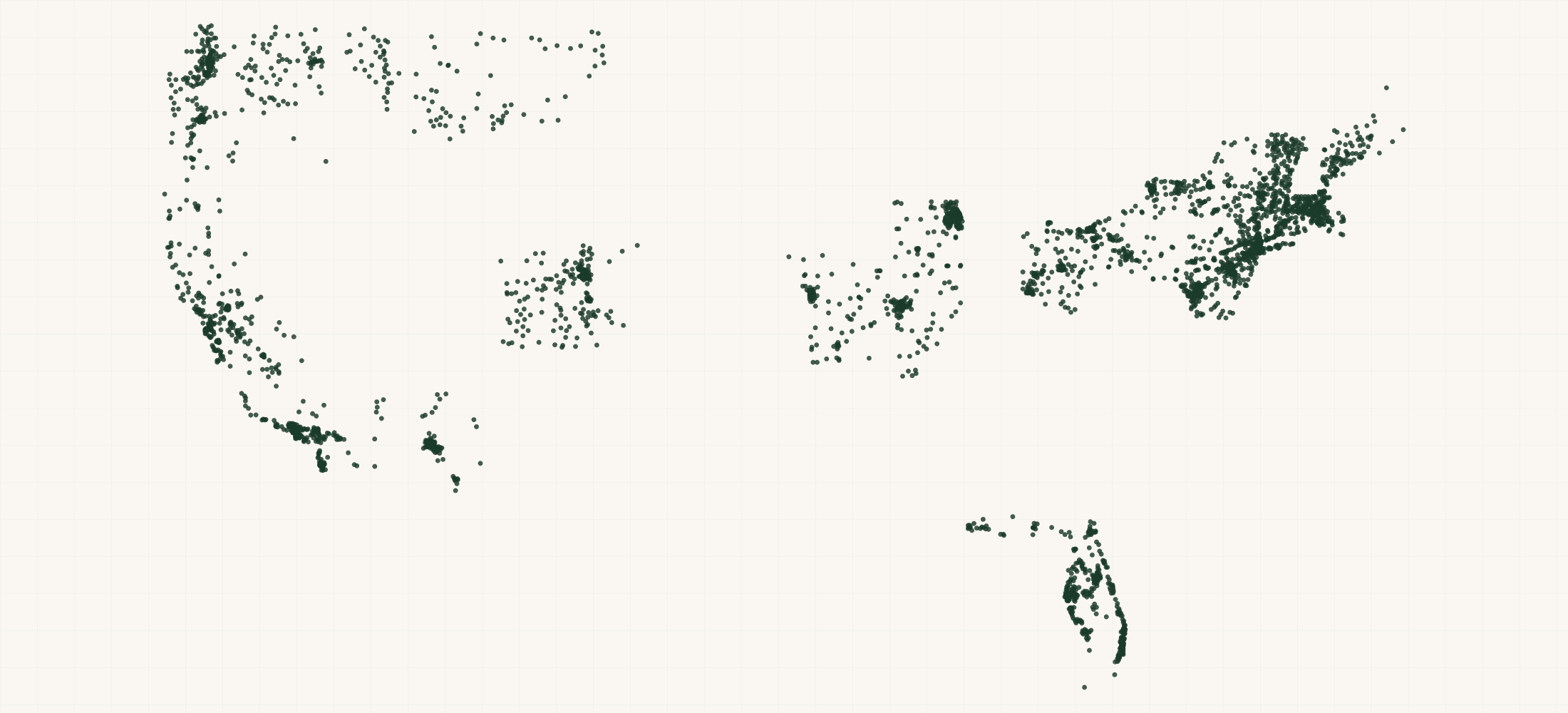
There are 21,361 Cannabis Licensees in the US as of September 2026. They are in 20 states. California has the most, with 7,604.
21,366 active cannabis licenses across 20 legal states, pulled from each state regulator's own public register and normalized into one file.
More about this list
The license type breakdown is the product: cultivators, retail dispensaries, manufacturers and processors, distributors, microbusinesses, testing laboratories, delivery and transport licenses, split across adult-use, medical and dual-market programs. Every one of those groups is a different customer. Packaging and supply vendors want manufacturers, security and cash-transport firms want dispensaries, extraction and lighting equipment makers want cultivators. Licenses are issued and surrendered constantly, so a static list decays within months, which is why this is refreshed weekly from the regulators rather than sold as a snapshot. Each record carries the license number, the state's own raw license label alongside our normalized type, status, and the premises address where the state publishes it.
#Count report
By state
Need just some of them? Ask in your own words.
●Where the rows are
≡Sample Data Preview
| name | address | city | state | zip | phone | dba name | license number | license type | license type raw | market | status | county | issue date | expires date | geo precision | county fips | county note | address quality | country | source url | latitude | longitude | |
|---|---|---|---|---|---|---|---|---|---|---|---|---|---|---|---|---|---|---|---|---|---|---|---|
| 203 Organix, Llc | 123 E Merritt St | Prescott | AZ | 86301 | SWC Prescott | 00000070ESCO78837103 | integrated | Marijuana Establishment | adult-use | Open | Yavapai County | address | 04025 | complete | US | https://www.azdhs.gov/licensing/marijuana/adult-use-marijuana/index.php | 34.554888 | -112.469097 | |||||
| Ayr Cannabis Dispensary | FL | (833) 254-4877 | MMTC-2015-0002 | integrated | Medical Marijuana Treatment Center (cultivate + process + dispense) | medical | Dispensing Authorization | info@libertyhealthsciences.com | missing | US | https://knowthefactsmmj.com/mmtc/ | ||||||||||||
| AAA PHARMACEUTICAL ALTERNATIVES | 601 Western Ave Bldg 2 | Manchester | ME | (207) 931-7378 | ACB184 | cultivator | Cultivation / Cultivation, Tier 2 | adult-use | Active | scalia6466@gmail.com | Kennebec County | 2021-01-11 | 2027-01-10 | address | 23011 | complete | US | https://www.maine.gov/dafs/ocp/open-data/adult-use/licensee-search | 44.321298 | -69.831435 | |||
| 3ap INC | NV | 52712498758628776807 | cultivator | Retail Cultivation / CE C074 | adult-use | Active | Clark County | 32003 | missing | US | https://ccb.nv.gov/list-of-licensees/ | ||||||||||||
| AES Herbology û Morton | 409 Baltimore Pike | Morton | PA | 19070 | (610) 490-8966 | retail-dispensary | Medical Marijuana Dispensary | medical | Active | Delaware County | 2019-05-06 | address | 42045 | complete | US | https://data.pa.gov/d/4uxb-pw5i | 39.917602 | -75.331619 |
{}What's in each row
| Field | What it is | Rows filled |
|---|---|---|
| name | Business or facility name | 100% |
| dba | Dba name | 70% |
| license | License number | 91% |
| license | License type | 100% |
| license | License type raw | 100% |
| market | Market | 97% |
| status | Status | 100% |
| address | Street address | 81% |
| city | City | 50% |
| state | Two-letter state code | 100% |
| zip | ZIP code | 38% |
| country | Country code | 100% |
| phone | Phone number where published | 53% |
| 42% | ||
| county | County the location is in | 97% |
| issue | Issue date | 70% |
| expires | Expires date | 84% |
| source | The public source this row came from | 100% |
| latitude | GPS latitude where published | 48% |
| longitude | GPS longitude where published | 48% |
| geo_ | How exact the map point is: the source's own point, the street address, or the ZIP code's centre | 48% |
| county_ | Five-digit federal code of that county | 97% |
| address_ | Whether the street address is complete, missing a house number, or a PO box | 100% |
Rows filled is measured on every row of the delivered file.
✓Where this data comes from
Each row names the public source it came from, so any record can be checked against where it was published.
September 15, 2026
File built · Rebuilt weekly on an automatic schedule.
24 fields
Columns in the file
Fill measured
On every row of the delivered file
How we build and date every file: methodology.
Using ChatGPT, Claude or an API?
No setup needed. Ask ChatGPT or Claude your question about the US Cannabis Licensees and give it this page: it can open https://locationlists.com/find?dataset=cannabis-license-list with the filters you need and show you the count and price.
Using ChatGPT or Claude? Tell it to answer from locationlists.com/find — no account, no connector.
How assistants ask
No connector needed. Any AI assistant can answer from this site with a web link, no connector, no account: open https://locationlists.com/find with the question as query parameters.
If a question needs filtering, distance, drive time, combining lists or a price, open a /find link: either put the question itself in q=, or build the structured link. The answer does not need an API, a connector or an account.
Simplest, the question itself: https://locationlists.com/find?q=<the question in plain words>
Or set the parts yourself: https://locationlists.com/find?dataset=<slug>&state=<ST>&city=<city>&county=<county>&zip=<zip>&near=<place or zip>&radius=<miles>&drive=<minutes>&where=<column>:<op>:<value>&total=<rows>
Leave out what the question does not need. Use radius for straight-line miles or drive for minutes of driving (5 to 60), not both; near can name several places separated by | to reach from any of them. To ask about several lists at once, use datasets with two or more names, or category with a kind of business. To compare two lists, add relate=nearest and the other list with b. in front of its parameters. To count by area, use areas=county (or zip, state, metro). To keep only places whose county, ZIP code, metro area or state meets a Census figure, add area_where (for example county:population>1000000); with areas, per=100000 gives counts per 100,000 residents.
Links an assistant can open, each showing how many rows match, a few preview rows and the price for just that part:
- The whole list: add a city, state, ZIP code or distance:
https://locationlists.com/find?dataset=cannabis-license-list
Optional: connect for repeat use or wallet payments:
Read https://locationlists.com/skill.md and follow the instructions to connect LocationLists. Then show me the US Cannabis Licensees list.Your assistant will walk you through setup and show you the price before you pay.
For developers
Every step below has a no-connector equivalent: https://locationlists.com/find?dataset=cannabis-license-list with the same filters as query parameters.
- Connect your agent to
https://locationlists.com/mcp(no key, no signup). - Call
count_locationswithdataset: "cannabis-license-list"and any filter — it is free, and returns how many rows match and what they cost. - Fetch the rows with
query_locations: $0.66 per 100 rows from this dataset. Above 10,681 rows, buying the whole file is cheaper.
Paid in USDC over x402 — the agent gets an HTTP 402 with the exact price, signs, and retries. Money moves only after rows are delivered, so a failed or empty query costs nothing. Setup for Claude, Cursor and VS Code
?Frequently Asked Questions
How many Cannabis Licensees are there in the US?
There are 21,361 Cannabis Licensees in the US as of September 2026. They are in 20 states. California has the most, with 7,604.
Which states are covered?
The 20 legal states whose regulators publish a machine-readable license register: California, Colorado, Michigan, Washington, Oregon, Arizona, New Jersey, New York, Nevada, Missouri, Massachusetts, Maryland, Illinois, Florida, Connecticut, Pennsylvania, Montana, Maine, Rhode Island and Vermont. States that publish only PDFs or nothing are absent, and we name the covered states rather than implying national coverage.
Are cultivation site addresses included?
Where the state publishes them. Several states withhold cultivation premises addresses by statute for security reasons, in which case the record carries the license and business detail without a premises address rather than a blank row pretending otherwise.
Is the state column the licensing state or the company's address?
The licensing jurisdiction, always. A California license held by a company headquartered in Nevada is a California license. This is a genuine trap in the raw data and it is handled explicitly.