Volleman's Dairy Retailers
United States · 574 locations
574 stores that carry Volleman's Dairy (574 in the US): every store on Volleman's Dairy's own store locator on vollemansdairy.com.
More about this list
Name, address, phone, website and the locator's own store details.
The file has all 574 locations across 5 states in one download. Building the same list by searching one area at a time tends to miss places, and a missed place looks like a gap in coverage that is not really there.
Need just some of them? Ask in your own words.
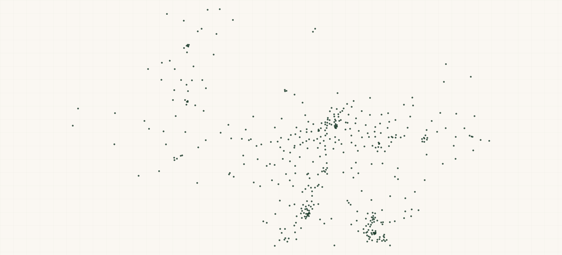
●Where the rows are
≡Sample Data Preview
| store name | address | city | state | zip | phone | website | brand | store id | phone source | website source | store type | status | directions url | brand locator store id | brand locator url | brand locator address | updated date | place from map point | is chain | chain name | chain store count | overture place id | overture name | overture category | overture brand | overture match meters | naics code | naics title | sic code | sic title | industry source | geo precision | county | county fips | county note | address quality | country | latitude | longitude | source |
|---|---|---|---|---|---|---|---|---|---|---|---|---|---|---|---|---|---|---|---|---|---|---|---|---|---|---|---|---|---|---|---|---|---|---|---|---|---|---|---|---|
| 1847 Market | 580 Graham Rd | College Station | TX | 77845 | Volleman's Dairy | 169dfb42403553-68223924 | returnable bottles | 12oz (non-returnable) | Listed | https://www.google.com/maps/dir/?api=1&destination=30.567688,-96.297196 | 68223924 | https://www.vollemansdairy.com/stores/ | 580 Graham Rd, College Station, TX 77845 | 2026-10-18 | Y | Market | 15 | source | Brazos County | 48041 | complete | US | 30.567688 | -96.297196 | Volleman's Dairy store locator | ||||||||||||||||
| Albertsons | 900 W 2nd St | Roswell | NM | 88201 | (575) 623-6100 | https://www.albertsonsmarket.com/ | Volleman's Dairy | 169dfb42403553-68268098 | Overture Maps place | Overture Maps place | returnable bottles | ice cream | Listed | https://www.google.com/maps/dir/?api=1&destination=33.393697,-104.535639 | 68268098 | https://www.vollemansdairy.com/stores/ | 900 W 2nd St, Roswell, NM 88201 | 2026-10-18 | Y | Albertsons | 3177 | 3003ffc0-f50f-45c7-8109-21210c0991bd | Albertsons Market | grocery_store | Albertsons | 31 | 445110 | Supermarkets and Other Grocery Retailers (except Convenience Retailers) | 5411 | Grocery Stores | Overture category of the matched place | source | Chaves County | 35005 | ZIP 88201 spans 2 counties; assigned to the county holding 87% of its land area | complete | US | 33.393697 | -104.535639 | Volleman's Dairy store locator | |
| Brookshire’s | 510 Kings Hwy | Shreveport | LA | 71104 | (318) 424-0853 | https://www.brookshires.com/store-information/Shreveport/78 | Volleman's Dairy | 169dfb42403553-66268270 | Overture Maps place | Overture Maps place | 12oz (non-returnable) | Listed | https://www.google.com/maps/dir/?api=1&destination=32.482366,-93.740616 | 66268270 | https://www.vollemansdairy.com/stores/ | 510 Kings Hwy, Shreveport, LA, 71104 | 2026-10-18 | Y | Brookshire’s | 331 | 375e4282-5ae3-43a7-b3a8-a63253c04d91 | Brookshire's | grocery_store | Brookshire's | 20 | 445110 | Supermarkets and Other Grocery Retailers (except Convenience Retailers) | 5411 | Grocery Stores | Overture category of the matched place | source | Caddo Parish | 22017 | ZIP 71104 spans 2 counties; assigned to the county holding 95% of its land area | complete | US | 32.482366 | -93.740616 | Volleman's Dairy store locator | |
| Brookshire’s | 8503 Dollarway Rd | White Hall | AR | 71602 | Volleman's Dairy | 169dfb42403553-66268302 | 12oz (non-returnable) | returnable bottles | Listed | https://www.google.com/maps/dir/?api=1&destination=34.27685,-92.091027 | 66268302 | https://www.vollemansdairy.com/stores/ | 8503 Dollarway Rd, White Hall, AR, 71602 | 2026-10-18 | Y | Brookshire’s | 331 | source | Jefferson County | 05069 | ZIP 71602 spans 2 counties; assigned to the county holding 82% of its land area | complete | US | 34.27685 | -92.091027 | Volleman's Dairy store locator | |||||||||||||||
| FRESH by Reasor's | 1230 W. Covell Rd. | Edmond | OK | 73003 | Volleman's Dairy | 169dfb42403553-66268229 | Listed | https://www.google.com/maps/dir/?api=1&destination=35.681214,-97.50042 | 66268229 | https://www.vollemansdairy.com/stores/ | 1230 W. Covell Rd., Edmond, OK, 73003 | 2026-10-18 | N | source | Oklahoma County | 40109 | complete | US | 35.681214 | -97.50042 | Volleman's Dairy store locator |
{}What's in each row
| Field | What it is | Rows filled |
|---|---|---|
| brand | The brand whose store locator lists the store | 100% |
| store | Store id (unique per place in this file) | 100% |
| store | Store name as the brand's locator lists it | 100% |
| address | Street address | 100% |
| city | City | 100% |
| state | State or province code (US always; outside the US where the locator gives one) | 100% |
| zip | ZIP or postal code | 96% |
| country | Two-letter country code | 100% |
| latitude | Latitude | 100% |
| longitude | Longitude | 100% |
| phone | Store phone | 70% |
| phone | Where the phone came from: the brand's store locator, or the matched Overture place | 70% |
| website | Store website | 67% |
| website | Where the website came from: the brand's store locator, or the matched Overture place | 67% |
| store | The brand's own tags for the store on its locator (product lines, store types, retailer) | 74% |
| status | Listed | 100% |
| directions | Google Maps directions link | 100% |
| brand | The store's id on the brand's locator | 100% |
| brand | The brand's store locator page | 100% |
| brand | The address as the brand's locator writes it in one line | 100% |
| source | Source of the row | 100% |
| updated | Date the brand's locator was read | 100% |
| is | Y when 5 or more stores in these brand lists carry the same store name | 100% |
| chain | Chain name | 81% |
| chain | Stores with that chain name across these brand lists | 81% |
| overture | Overture Maps place id of the matched place (join key to Overture data) | 71% |
| overture | Name of the matched Overture place | 71% |
| overture | Overture category of the matched place | 71% |
| overture | Brand of the matched Overture place | 50% |
| overture | Distance between the store and the matched Overture place, in metres | 71% |
| naics | NAICS 2022 code | 68% |
| naics | NAICS title | 68% |
| sic | SIC code | 68% |
| sic | SIC title | 68% |
| industry | Where the industry code came from | 68% |
| geo_ | How the map point was set | 100% |
| county | US county (from the store's coordinates) | 100% |
| county_ | US county FIPS code | 100% |
| county_ | Set when the ZIP spans counties | 45% |
| address_ | complete, no house number, po box, missing city or zip or missing | 100% |
Rows filled is measured on every row of the delivered file.
✓Where this data comes from
Each row names the public source it came from, so any record can be checked against where it was published.
October 18, 2026
Snapshot built
41 fields
Columns in the file
Fill measured
On every row of the delivered file
How we build and date every file: methodology.
Using ChatGPT, Claude or an API?
No setup needed. Ask ChatGPT or Claude your question about the Volleman's Dairy Retailers and give it this page: it can open https://locationlists.com/find?dataset=vollemans-dairy-retailers with the filters you need and show you the count and price.
Using ChatGPT or Claude? Tell it to answer from locationlists.com/find — no account, no connector.
How assistants ask
No connector needed. Any AI assistant can answer from this site with a web link, no connector, no account: open https://locationlists.com/find with the question as query parameters.
If a question needs filtering, distance, drive time, combining lists or a price, open a /find link: either put the question itself in q=, or build the structured link. The answer does not need an API, a connector or an account.
Simplest, the question itself: https://locationlists.com/find?q=<the question in plain words>
Or set the parts yourself: https://locationlists.com/find?dataset=<slug>&state=<ST>&city=<city>&county=<county>&zip=<zip>&near=<place or zip>&radius=<miles>&drive=<minutes>&where=<column>:<op>:<value>&total=<rows>
Leave out what the question does not need. Use radius for straight-line miles or drive for minutes of driving (5 to 60), not both; near can name several places separated by | to reach from any of them. To ask about several lists at once, use datasets with two or more names, or category with a kind of business. To compare two lists, add relate=nearest and the other list with b. in front of its parameters. To count by area, use areas=county (or zip, state, metro). To keep only places whose county, ZIP code, metro area or state meets a Census figure, add area_where (for example county:population>1000000); with areas, per=100000 gives counts per 100,000 residents.
Links an assistant can open, each showing how many rows match, a few preview rows and the price for just that part:
- Only Texas, the state with the most: https://locationlists.com/find?dataset=vollemans-dairy-retailers&state=TX
- Within 25 miles of Dallas, TX, the busiest area: https://locationlists.com/find?dataset=vollemans-dairy-retailers&near=Dallas+TX&radius=25
- Within a 30-minute drive of Dallas, TX: https://locationlists.com/find?dataset=vollemans-dairy-retailers&near=Dallas+TX&drive=30
- Only rows where isChain is Y: https://locationlists.com/find?dataset=vollemans-dairy-retailers&where=isChain%3Aeq%3AY
- Every Frozen & Refrigerated Foods list combined, within 25 miles of Piney Point Village, TX: https://locationlists.com/find?category=frozen-and-refrigerated-foods&near=Piney+Point+Village+TX&radius=25
- Each one's nearest Salumi Australia Retailers, in Texas, with miles: https://locationlists.com/find?dataset=vollemans-dairy-retailers&state=TX&relate=nearest&k=1&b.dataset=salumi-australia-retailers&b.state=TX
- The whole list: add a city, state, ZIP code or distance:
https://locationlists.com/find?dataset=vollemans-dairy-retailers - In plain words: "Volleman's Dairy Retailers in Texas": https://locationlists.com/find?q=Volleman's+Dairy+Retailers+in+Texas
- In plain words: "Volleman's Dairy Retailers within 25 miles of Dallas, TX": https://locationlists.com/find?q=Volleman's+Dairy+Retailers+within+25+miles+of+Dallas%2C+TX
Optional: connect for repeat use or wallet payments:
Read https://locationlists.com/skill.md and follow the instructions to connect LocationLists. Then show me the Volleman's Dairy Retailers list.Your assistant will walk you through setup and show you the price before you pay.
For developers
At 574 records this dataset is not sold by the row — buy the file. Without a connector, open https://locationlists.com/find?dataset=vollemans-dairy-retailers. An agent connected to https://locationlists.com/mcp can still search it, read a free sample file of up to 10 rows and buy the whole file itself. How agent purchasing works
?Frequently Asked Questions
Where does this data come from?
From Volleman's Dairy's own store locator on vollemansdairy.com. We read every store on its map on 2026-10-18. A store the map shows twice (same name and address) is one row.
What is one row?
One store on the brand's locator, with the brand's own tags for it (storeType) and any custom fields the locator shows.
Does it include stores outside the US?
No. Every store in this list is in the US.
Where do websites and phones come from?
From the brand's locator where it gives them. Otherwise from the Overture Maps place at the same spot with the same name. phoneSource and websiteSource say which.
How complete are phones and websites?
400 of the 574 stores have a phone, and 385 of the 574 have a website.