Ag Retail & Grain Facilities
U.S. · 10,669 locations
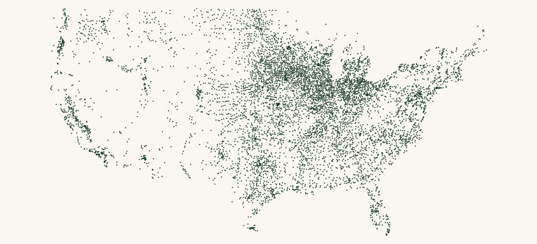
There are 10,669 Ag Retail & Grain Facilities in the US as of September 2026. They are in all 50 states, DC and Puerto Rico. Iowa has the most, with 926.
10,669 agricultural retail and grain-handling facilities across the United States, with a street address on 91%, coordinates on 96% and a phone on 91%.
More about this list
Read the facility type column before you buy: 8,764 of these are ag retail — the agronomy, seed, crop-protection and fertiliser outlets farmers actually buy inputs from — and 1,905 are grain handling, split into 1,440 elevators, 240 processing plants and 225 terminals. We name this file for both because calling 10,669 records a grain elevator list would be false; the grain-handling portion alone is roughly a fifth of the estimated 9,000 US elevators. Named operators include Nutrien Ag Solutions, Helena, The Andersons and Scoular, with state licensing registers from Iowa and Nebraska adding independents. Equipment manufacturers, grain handling and storage suppliers, agronomy input makers, rail and logistics providers and ag-tech vendors all sell into these facilities, and the operator column tells you which are corporate accounts and which are independent co-ops.
#Count report
By state
Need just some of them? Ask in your own words.
●Where the rows are
≡Sample Data Preview
| name | address | city | state | zip | phone | website | operator | facility type | license number | commodities | rail served | geo precision | county | county fips | county note | address quality | country | latitude | longitude | source | source url |
|---|---|---|---|---|---|---|---|---|---|---|---|---|---|---|---|---|---|---|---|---|---|
| Alaska Salmon Fertilizer | 4020 Crosson Dr | Anchorage | AK | 99517 | (907) 202-6997 | http://www.alaskasalmonfertilizer.com/ | ag-retail | source | Anchorage Municipality | 02020 | complete | US | 61.18424 | -149.94208 | overture | https://docs.overturemaps.org/release/2026-08-19.0/ | |||||
| Nutrition 101, Llc | 4782 Joe Frank Harris Pkwy NW | Adairsville | GA | 30103 | (765) 778-1101 | https://www.101.us | ag-retail | source | Bartow County | 13015 | complete | US | 34.332751 | -84.899496 | overture | https://docs.overturemaps.org/release/2026-08-19.0/ | |||||
| Tameron Acres | 3201 Park Mills Rd | Adamstown | MD | 21710 | (240) 815-4711 | ag-retail | source | Frederick County | 24021 | complete | US | 39.32003 | -77.39085 | overture | https://docs.overturemaps.org/release/2026-08-19.0/ | ||||||
| New Ark Farms | 360 Co Rd 579 | Alexandria Twp | NJ | 08802 | (973) 747-8724 | http://ironboundhardcider.com/farm-share-program | ag-retail | source | Hunterdon County | 34019 | complete | US | 40.627674 | -75.042329 | overture | https://docs.overturemaps.org/release/2026-08-19.0/ | |||||
| Highway 28 Farm & Garden | 1319 Hwy 28 S | Abbeville | SC | 29620 | (864) 366-9522 | https://www.southernstates.com/farm-store | ag-retail | source | Abbeville County | 45001 | complete | US | 34.184905 | -82.406948 | overture | https://docs.overturemaps.org/release/2026-08-19.0/ |
{}What's in each row
| Field | What it is | Rows filled |
|---|---|---|
| name | Business or facility name | 100% |
| operator | Operator | 22% |
| facility | Facility type | 100% |
| license | License number | 1% |
| address | Street address | 91% |
| city | City | 100% |
| state | Two-letter state code | 100% |
| zip | ZIP code | 91% |
| country | Country code | 100% |
| phone | Phone number where published | 91% |
| website | Website where published | 75% |
| latitude | GPS latitude where published | 100% |
| longitude | GPS longitude where published | 100% |
| commodities | Commodities | 5% |
| source | Which source the record came from | 100% |
| source | The public source this row came from | 100% |
| geo_ | How exact the map point is: the source's own point, the street address, or the ZIP code's centre | 100% |
| county | County the location is in | 100% |
| county_ | Five-digit federal code of that county | 100% |
| address_ | Whether the street address is complete, missing a house number, or a PO box | 100% |
Rows filled is measured on every row of the delivered file.
✓Where this data comes from
Each row names the public source it came from, so any record can be checked against where it was published.
September 14, 2026
File built
22 fields
Columns in the file
Fill measured
On every row of the delivered file
How we build and date every file: methodology.
Using ChatGPT, Claude or an API?
No setup needed. Ask ChatGPT or Claude your question about the Ag Retail & Grain Facilities and give it this page: it can open https://locationlists.com/find?dataset=ag-retail-grain-facility-list with the filters you need and show you the count and price.
Using ChatGPT or Claude? Tell it to answer from locationlists.com/find — no account, no connector.
How assistants ask
No connector needed. Any AI assistant can answer from this site with a web link, no connector, no account: open https://locationlists.com/find with the question as query parameters.
If a question needs filtering, distance, drive time, combining lists or a price, open a /find link: either put the question itself in q=, or build the structured link. The answer does not need an API, a connector or an account.
Simplest, the question itself: https://locationlists.com/find?q=<the question in plain words>
Or set the parts yourself: https://locationlists.com/find?dataset=<slug>&state=<ST>&city=<city>&county=<county>&zip=<zip>&near=<place or zip>&radius=<miles>&drive=<minutes>&where=<column>:<op>:<value>&total=<rows>
Leave out what the question does not need. Use radius for straight-line miles or drive for minutes of driving (5 to 60), not both; near can name several places separated by | to reach from any of them. To ask about several lists at once, use datasets with two or more names, or category with a kind of business. To compare two lists, add relate=nearest and the other list with b. in front of its parameters. To count by area, use areas=county (or zip, state, metro). To keep only places whose county, ZIP code, metro area or state meets a Census figure, add area_where (for example county:population>1000000); with areas, per=100000 gives counts per 100,000 residents.
Links an assistant can open, each showing how many rows match, a few preview rows and the price for just that part:
- Only Illinois, the state with the most: https://locationlists.com/find?dataset=ag-retail-grain-facility-list&state=IL
- Within 25 miles of Chicago, IL, the busiest area: https://locationlists.com/find?dataset=ag-retail-grain-facility-list&near=Chicago+IL&radius=25
- Within a 30-minute drive of Chicago, IL: https://locationlists.com/find?dataset=ag-retail-grain-facility-list&near=Chicago+IL&drive=30
- Every Farm & Ranch Supply list combined, within 25 miles of Gilman, IL: https://locationlists.com/find?category=farm-ranch-supply&near=Gilman+IL&radius=25
- Each one's nearest Purina Animal Nutrition Retailers, in Illinois, with miles: https://locationlists.com/find?dataset=ag-retail-grain-facility-list&state=IL&relate=nearest&k=1&b.dataset=purina-animal-nutrition-retailers&b.state=IL
- The whole list: add a city, state, ZIP code or distance:
https://locationlists.com/find?dataset=ag-retail-grain-facility-list - In plain words: "Ag Retail & Grain Facilities in Illinois": https://locationlists.com/find?q=Ag+Retail+%26+Grain+Facilities+in+Illinois
- In plain words: "Ag Retail & Grain Facilities within 25 miles of Chicago, IL": https://locationlists.com/find?q=Ag+Retail+%26+Grain+Facilities+within+25+miles+of+Chicago%2C+IL
Optional: connect for repeat use or wallet payments:
Read https://locationlists.com/skill.md and follow the instructions to connect LocationLists. Then show me the Ag Retail & Grain Facilities list.Your assistant will walk you through setup and show you the price before you pay.
For developers
Every step below has a no-connector equivalent: https://locationlists.com/find?dataset=ag-retail-grain-facility-list with the same filters as query parameters.
- Connect your agent to
https://locationlists.com/mcp(no key, no signup). - Call
count_locationswithdataset: "ag-retail-grain-facility-list"and any filter — it is free, and returns how many rows match and what they cost. - Fetch the rows with
query_locations: $0.93 per 100 rows from this dataset. Above 5,335 rows, buying the whole file is cheaper.
Paid in USDC over x402 — the agent gets an HTTP 402 with the exact price, signs, and retries. Money moves only after rows are delivered, so a failed or empty query costs nothing. Setup for Claude, Cursor and VS Code
?Frequently Asked Questions
How many Ag Retail & Grain Facilities are there in the US?
There are 10,669 Ag Retail & Grain Facilities in the US as of September 2026. They are in all 50 states, DC and Puerto Rico. Iowa has the most, with 926.
Is this a grain elevator list?
Partly, and we would rather be precise. 1,905 of the 10,669 records are grain-handling facilities — elevators, terminals and processing plants — and the rest are agricultural retail outlets. The facilityType column separates them cleanly. If you only want elevators, filter to those 1,905 and know that is about a fifth of the national estimate.
Why is there no storage capacity?
Because no reachable source publishes it per facility. The federal warehouse licensing dashboard holds bushel capacity but only exports a commodity summary, and its underlying data requires a browser session we could not obtain. Rather than ship a column that is empty on every row and looks like a field, we left it out entirely.
Which big grain companies are missing?
Cargill, ADM, Bunge and CHS. None publishes an enumerable facility locator — CHS ships a static image map, the others block automated access. Their facilities appear only where a state register or the mapping spine catches them. We name the gap rather than implying full coverage of the majors.